History and Importance
The Federal-Aid Highway Act of 1956 authorized the creation of an interlocking national highway system, free of tolls or other user fees and included plans for the "Circumferential Highway," an interstate that circles the Washington, D.C. area. Construction began on I-495 (also known as the Capital Beltway), in 1958 and was completed in 1964. The road is sixty-four miles long, with twenty-two miles in Virginia and forty-two miles on Maryland's side of the Potomac River. The two connections between the states are the American Legion Bridge and the Woodrow Wilson Bridge.
Figure 4: The Capital Beltway and Surrounding Area
Source: Roads to the Future |
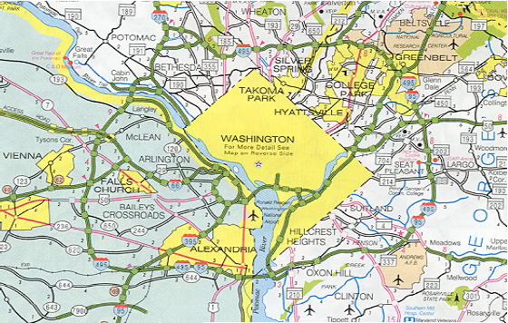
The Beltway is the only circumferential freeway in Northern Virginia and provides interregional connections to many secondary roads in Maryland and Virginia, facilitating mobility and growth in employment, commerce, and residential development. In Maryland, the highway is located within Montgomery and Prince George's counties and is generally eight lanes wide except for the segment between the I-270 West and East Spurs where it is six lanes wide.
When it opened, the Capital Beltway had two lanes in each direction from the I-95 / I-395 (Shirley Highway) interchange in Springfield to VA 193 in McLean. The remaining sections of I-495 in Virginia and the entire length of I-495 in Maryland consisted of six traffic lanes (three in each direction). Engineers designed Maryland's portion to carry 55,000 vehicles per day and Virginia's to carry 49,000. Both figures were exceeded by the end of 1965. In 1972, Maryland widened 29 miles of the Beltway to eight lanes. In 1977, Virginia did likewise, denoting the last major expansion of the Virginia portion of the Beltway. 25 Finally, during the early 1990's, Maryland extended its eight-lane widening for four miles.
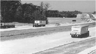
Figure 5: The Capital Beltway in 1964