4.6.2 National highways
WA is the largest state geographically. Of Australia's 34,656 km of national highways (which include the National Land Transport Network highways and other key freight routes) identified in the Audit, 9,946 km (29 per cent) are in WA. This includes the following national highway links connecting the capital cities:
■ Perth to Adelaide (Great Eastern Highway/Eyre Highway Routes 1 and 94); and
■ Perth to Darwin (Great Northern Highway Routes 1 and 95).
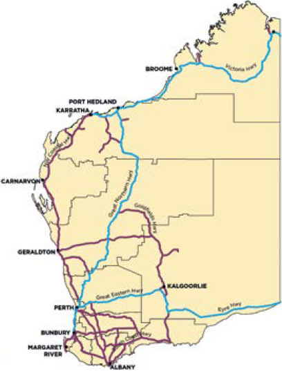
Figure 87 shows the National Land Transport Network highways and the other key WA freight routes included in the Audit. Together these play an important role in facilitating industry and enabling of business and community activity.
Many of the more remote parts of central, eastern and north-western WA do not have national highways or designated key freight routes.
Figure 87: National Land Transport Network highways and key freight routes in Western Australia 2011
 National Land Transport Network Highway
 Key Freight Route
The map shows highways identified in the Audit. Data was not available for all of these highways. Source: ACIL Allen Consulting (2014a)
Five per cent of WA's roads have a 1-star safety rating under the Australian Road Assessment Program (AusRAP), while 23 per cent are 2-star rated and 69 per cent are 3-star rated. The highest attainable rating is 5 stars.
The DEC of WA's national highways is projected to increase from $726 million in 2011 to $1.42 billion in 2031, a rise of 95 per cent. The largest economic contribution comes from the mining areas of Bunbury, Pilbara and Mid West, as well as Esperance, Gascoyne, Albany, where the DEC is projected to grow by 200 to 260 per cent from 2011 to 2031.