5.6.2 National highways
Of Australia's 34,656 km of national highways (which include the National Land Transport Network highways and other key freight routes) identified in the Audit, 3,860 km are in SA. This includes the following national highway links connecting Australia's capital cities:
■ Adelaide to Perth (Eyre Highway Route 1);
■ Adelaide to Darwin (Stuart Highway Route 87);
■ Adelaide to Sydney (Sturt Highway Route 20); and
■ Adelaide to Melbourne (Dukes highway and Western Highway Route 8).
Key freight routes in SA include roads serving Port Augusta, Whyalla, Port Lincoln, Leigh Creek and Roxby Downs. In 2011, the national highways in SA carried an average of 68,110 vehicles per day.
Figure 97 shows the National Land Transport Network highways and the other key SA freight routes included in the Audit. Together these routes play an important role in facilitating industry and enabling business and community activity.
The DEC of these roads in 2011 was estimated at $511 million. This is projected to increase to $722 million in 2031, an increase of 41 per cent. These are relatively small figures in the national context. The total DEC for national highways and key freight routes in 2011 was $9.5 billion. This is projected to grow to $15.6 billion in 2031.
Figure 97: National Land Transport Network highways and key freight routes South Australia 2011
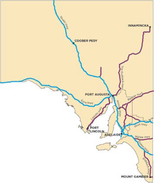
 National Land Transport Network Highway
 Key Freight Route
The map shows highways identified in the Audit. Data was not available for all of these highways.
Source: ACIL Allen Consulting (2014a)
The most economically significant road corridors run north from Adelaide to the mining centres and through to Darwin. The DEC for these roads is projected to increase by 154 per cent to 2031, marginally faster than the projected increase of around 138 per cent for the highways connecting to the east and west coast capital cities.
The SA Government's Regional Mining and Infrastructure Plan441 identifies that increased capacity will be needed to service increased mining sector production. The draft Integrated Transport and Land Use Plan442 articulates the importance of the Strzelecki Track in supporting the expanding gas fields in the Cooper Basin.
_________________________________________________________________________________________
441. South Australian Department of Planning, Transport and Infrastructure (2014), pp. 36-37
442. South Australian Department of Planning, Transport and Infrastructure (2013)