8.6.2 National highways
Of Australia's 34,656 km of national highways (which include the National Land Transport Network highways and other key freight routes), 4,517 km are in the NT. This includes the following national highway links connecting the capital cities:
■ Darwin to Adelaide (Stuart Highway Routes 1 and 87);
■ Darwin to Brisbane (Stuart Highway, Barkly Highway Routes 1, 87 and 66); and
■ Darwin to Perth (Stuart Highway and Victoria Highway Routes 1 and 95).
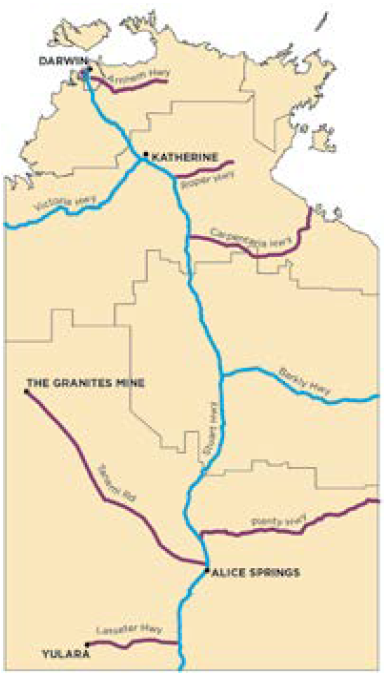
In 2011, the national highway routes in the NT were used by 8,150 vehicles each day. Figure 112 shows the National Land Transport Network highways and other key NT freight routes included in the Audit. Together these routes play an important role in facilitating the production processes for industry and enabling the activities of business and the community.
The DEC of the NT's national highways is projected to double from $502 million in 2011 to $1.01 billion in 2031, or 6.5 per cent of the projected national total DEC for national highways of $15.6 billion. This represents an annual growth rate of 3.6 per cent, which is higher than the projected national average of 2.5 per cent.
The NT has on average a lower quality national highway network than other states, due to the sparse population and long distances, extreme weather events, and relatively low levels of road utilisation.
Figure 112: National Land Transport Network highways and key freight routes in the Northern Territory 2011
 National Land Transport
Network Highway
 Key Freight Route
The map shows highways identified in the Audit. Data was not available for all of these highways.
Source: ACIL Allen Consulting (2014a)